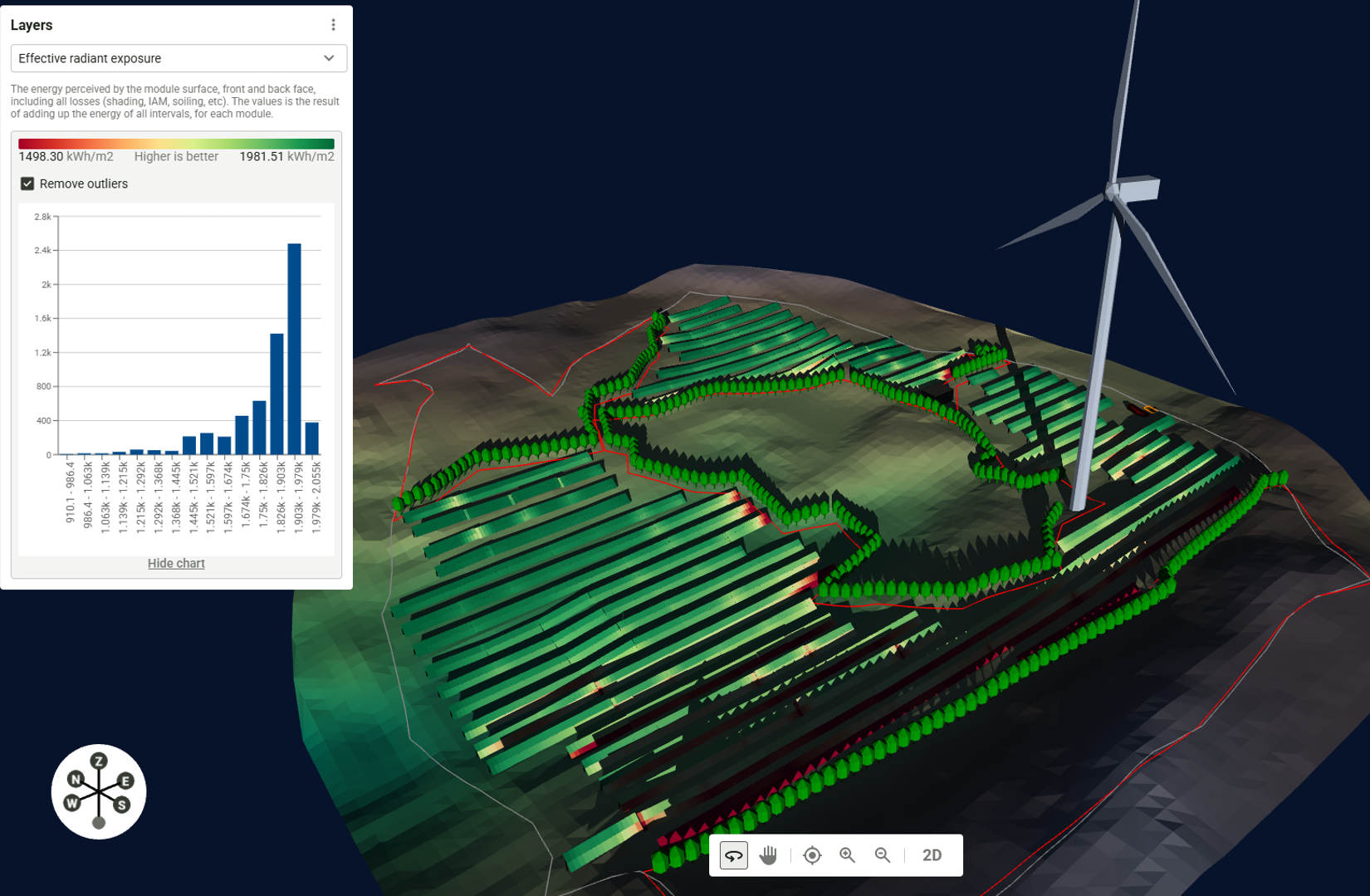
RatedPower cierra el tercer trimestre de 2026 con actualizaciones que refuerzan la precisión de sombreado, la precisión topográfica y el modelado de sistemas de almacenamiento de energía en baterías (BESS) en proyectos fotovoltaicos y de BESS a escala utility.
Why it matters: Precision modeling keeps your IRR from collapsing when the actual pile-driving starts and the bank's independent engineer checks your math.
Flick AI is a CRM for solar installers: the AI answers WhatsApp leads in seconds, builds proposals with automatic panel layouts and books the site visit. See how it works.
If I had a Euro for every time a developer handed me a layout designed on a 'flat earth' assumption only to find out the site has more wrinkles than a Shar Pei, I’d be retired in the Algarve. RatedPower’s push into high-resolution topography isn't just a software polish; it’s a necessary correction for an industry that has been playing fast and loose with shading losses for far too long.
The 2% Yield Gap is Killing Your IRR
In the utility-scale game, a 2% discrepancy between your P50 model and reality is the difference between a project that’s bankable at a competitive rate and one that gets a 'thanks but no thanks' from Santander or BBVA. When you’re dealing with bifacial modules on trackers—now the default for any serious project in Iberia—the interaction between diffuse light, ground albedo, and terrain-induced shading is incredibly complex. If your software isn't accounting for the precise slope of every single row on a 5-degree undulating hill, your production estimates are essentially fiction.
BESS: Moving Beyond the Spreadsheet
The inclusion of advanced BESS modeling is the real pivot here. We are rapidly moving away from 'solar-plus-a-box' toward sophisticated energy arbitrage. If you aren't modeling degradation curves and C-rates against the volatility of OMIE prices, you aren't building a power plant; you're gambling. Enverus (RatedPower’s parent company) knows that data is the only hedge against price cannibalization. For an EPC or developer, these tools allow you to finally stop guessing how many MWh you’ll actually discharge during the lucrative evening peak versus what you lose to round-trip efficiency and thermal management.